Archive
McCloud Falls and Castle Lake
As promised, here are some photos from McCloud Falls, near Shasta, CA.
The lower falls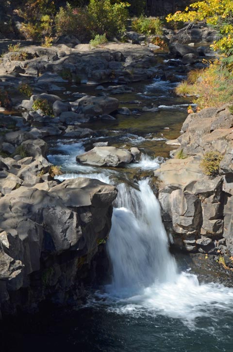
The middle falls:

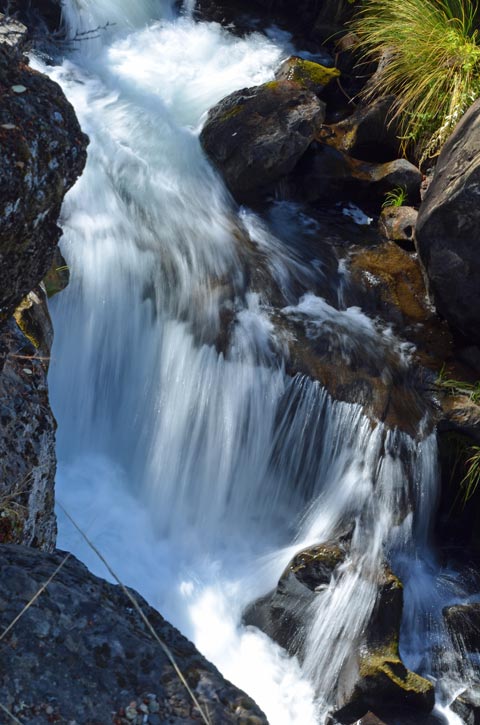
The upper falls:

Castle Lake, located up high west of Lake Siskiyou, was so pretty. Here are some images:


Today, we’re in the RV park of the Bordertown Casino, Nevada, running away from a big storm that’s due to hit northern California late tomorrow. If we have calculated correctly, we’ll be south and east of it by the time it hits. Phew!
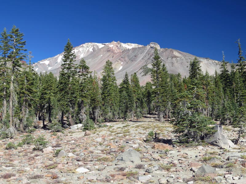
Panther Meadows
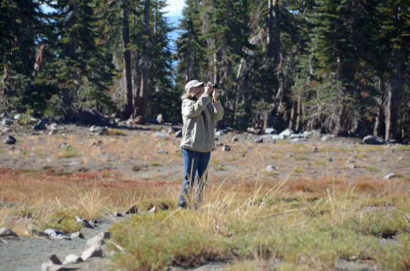
After renewing at the campground for another night, we headed to the Visitor Center to find out what to see.
The list was Panther Meadows; McCloud lower, middle and upper falls; and Castle Lake.
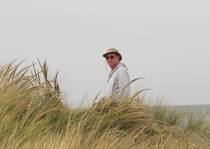
OK, then, off we set up the hill to around 7,500 feet (only half the elevation of Mount Shasta) and Panther Meadows. There’s a primitive campground there with quite a few folks staying. By the way, it was cold (39 deg) this morning at only 4,000 feet.
Gorgeous.


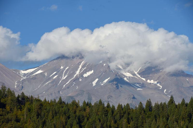
Then we wound down the hill and decided to have lunch – at Burger Express – and guess what we could see out of the window whilst we ate?

More later about McCloud Falls and Castle Lake.
Interregnum
The Lance Owners fun can be found on This Thread (requires registration, but no payment).
So, we set off this morning, kind of starting out on our way home. South. Towards the warm.
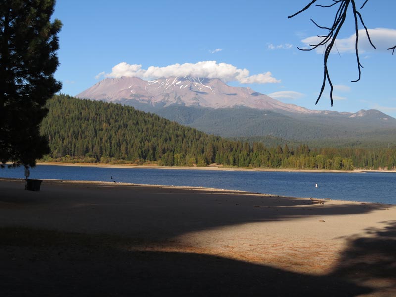
First stop, Lake Siskiyou. Views of Mt. Shasta.
And Lake Siskiyou and Mt. Shasta
Tomorrow, relax day, pootle around, since today, B got laundry done and we went grocery shopping, so the time is going to be completely free.
Good company, good weather.
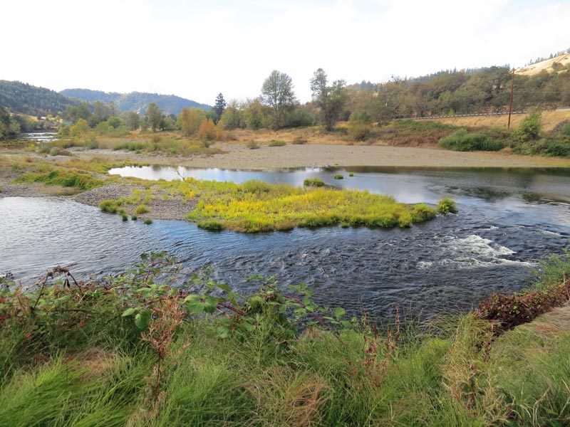
We set off from Myrtle Creek to go east on OR 227. Well, that was fun. Lazy turns and pastoral countryside whilst we followed the South Umpqua River east towards its source, but then, when we split from the river, it was twist and turn, twist and turn, to the summit, and an easy grade down to Hwy 62, and shortly thereafter, our destination, Joseph H. Stewart State Recreation Area.
Which is a very pretty campground, with lots of space between sites, and a view of the Lost Creek Reservoir:

It also has a bunch of trails, which we started out upon:

More importantly, there’s a bunch of fellow Lance Trailer users here this weekend for some brand based fellowship and it’s wonderful to see some faces that we haven’t seen for a while.
There’s a potluck tomorrow, and that will be great fun.
East Bound
Leaving Bullard State Recreation Area it was rainy, and continued so as we headed East, following the Coquille River.
We had prioritized things, we needed a place with a laundry (we had a huge load of laundry to do), a place with decent wifi (my Surface Pro needs a huge update), and a place which will allow us to wash all the grime off the Xterra and trailer.
2 out of 3 . The wifi sucks here at “On the River Golf & RV Resort” at Myrtle Creek on the beautiful South Umpqua River:
That’s the view from the back window of the trailer.
And because the guys here are great, they’ve said it’s OK to wash the grime off. Laundry was fine, too, especially as B. did it whilst I made lunch.
As I write this, it’s 9 pm and *still* raining. Forecast looks better for tomorrow.
We’ll see.
Why ‘Seven Devils’?
Still damp but not quite the incessant rain of the last day.
So we set off south on Hwy 101 Coast Highway. An easy jaunt into Coos Bay and Sunset Bay State Park. We pootled around the park for a look, and decided to take a gander at Bullard State Park, a little south from there.
The GPS took us along Seven Devils Road to Hwy 101. I pondered why it was named 7 Devils, but here’s the thing; if you were on a sportbike, you’d whoop with joy around all those curves.
On arrival at Bullard, we decided to stay there (here) a couple of nights – nothing against Sunset Bay, but it didn’t seem sufficiently different/better to backtrack there.
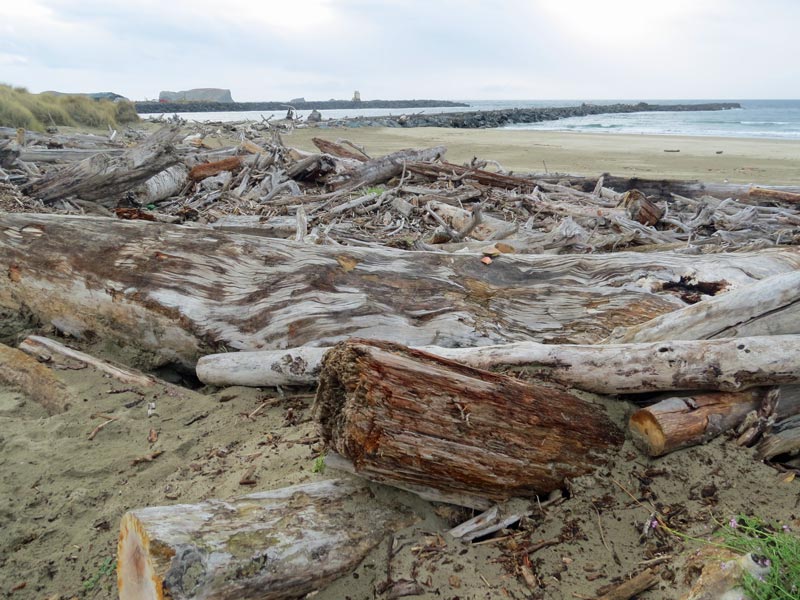
We took a look at the now unused Coquille River lighthouse:

and marveled at the collection of driftwood near the mouth of the river:
and clambered over the dunes:
Then we went back to the trailer and chilled.
Not sure what we’ll do tomorrow, but that’s OK 🙂
Edit (10/4/2016):
We asked the really lovely lady at the Visitor Center in Coos Bay what 7 Devils Road was all about, and she had no idea, but pulled out her phone and Googled it. Which resulted in a long treatise about the area, but no answer. We asked the equally lovely lady in the History Museum in Coos Bay the same question, and she said it was because of the ‘devilish’ curves on the road.
In that same museum was the explanation that the ‘7 Devils’ represented the 7 hills along the road linking Sunset Bay to Bullards Beach. So there you have it.
We also went to the Bandon Museum: These folks don’t seem to be able to learn lessons about about having town fires.
On a more poignant note, the guy who filled up our tank in Bandon told us that he gave up catching crabs for a living (and a seriously good living) because so many of his coworkers were losing their lives in the treacherous sand bar waters nearby. Sad reflection.
Water, water, everywhere…
Deities, the skies opened last night.
Several problems:
We left stuff outside that got soaked, shoes, mats, fire logs, that stuff – and it took ages and quite some ingenuity to get them dry – involving the use of space heaters and microwave ovens.
The trailer leaked. One we knew about, the front window, and we managed to sop that up OK. The other was new, coming in through the central overhead light fitting, which should be sealed, so there must be some of sealing around the ac unit or somewhere else on the roof that is allowing water to get into the light fitting. The symptoms were weird. The light decided that it was a nightlight – a couple of LEDs came on in without human intervention. All was gradually resolved when we unscrewed the fitting and dried out the electronics.
Because we’re camped under tall pine trees, what happens is that when it rains, the pines absorb the water, and then, over hours, drop that water in big gobs on to the trailer which sounds like a bunch of woodpeckers playing random snare drum solos on the roof!
We had brunch at the ‘Little Brown Hen’ in Florence, which was really good.
So, the day wore on and dried out a little and we got some nice photos:
As B sez, a little like ballet dancers.

Florence Beach


Florence Harbor

More Haste = Less Speed
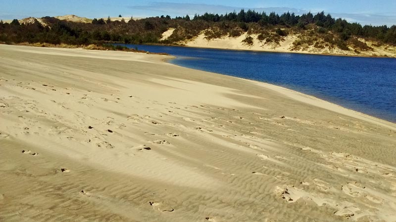
We broke camp in Lincoln City to light rain, and headed south towards a campground which we visited about a year ago. Jessie Honeyman State Recreation Area, about 80 miles south on Pacific Coast Highway.
We expected the journey to be tiresome with lots of ‘pottering’ tourists (like us), but what was absurd was that a group of motorcyclists (actually, the one at the back of the pack), who seemed unable to go around any curves at much greater than walking pace. An utter embarrassment to my fellow motorcycle riders, this one.
Anyhow, more haste led to less speed, as we arrived at the campground before the previous occupant of our reserved spot had left, so we had to hang around in the day visitors area for a couple of hours, made a sandwich for lunch and then hiked a few trails.
The sand dunes are huge here:
Today’s Lake Photo:
Oregon Coast
Today, B is baking more white bread. It smells delicious 🙂
The skies were grey and the temps were in the mid 50’s. Winter draws on! Spotting with rain, but no big deal.
We took the sphagnum bog boardwalk ….

… to the beach, and by the ‘Smallest River in the USA’, the D River. We walked a mile south to J’s Fish and Chips, and for $6 each we got 2 big pieces of deliciously fried cod, curly fries and a soda. Fantastic! – and this coming from an Englishman by origin, who grew up in post WWII England when fish and chips was about the only fast food you could get.
We drove south to the Devil’s Punchbowl, and ambled around for a little while in the cold wind, and then to Yaquina Head.
There were keen surfers (in the cold wind)….

… and although the light made everything seem a little foreboding, Yaquina Beach was beautiful…

Devil’s Lake
It was an easy drive from Champoeg to Lincoln City. Much easier, in fact, than driving through Lincoln City itself, where despite reasonable speed limits, the average speed was about 5 mph.
It’s a bit colder by the ocean, but not horribly so.
We got some chores done, including purchasing a higher quality hose to replace the cheapo one that kept falling out of the holding tank spritzer inlet. The new one is cast brass rather than stamped, and it fits and holds much, much better.
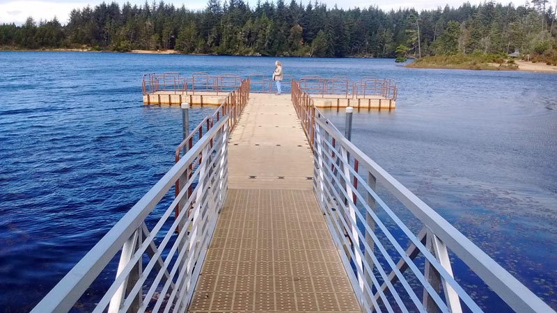
So, this is Devil’s Lake:
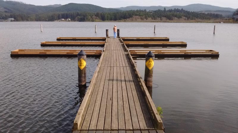
with B at the end of the boat launch.
First lake that we’ve come across that isn’t way down. Sold its soul? Nah, it’s connected to the ocean.

You must be logged in to post a comment.