Archive
On the way to Yellowstone National Park
24th August 2015
So, a couple of days ago, when we were in Utah State Park, I (Simon) was looking at the map, and trying to think about where to go next. I’d shruggingly figured Idaho, for no particular reason other than we’d never been there, and then, I saw on the map, that Grand Teton National Park and Yellowstone National Park were right there, next to Idaho, in Wyoming.
So I sez to B, ‘How many times in a lifetime are we going to be this close to these parks, with no particular timetable to get home, or anywhere, really? How could we miss the opportunity to go?
So we did, and we are.
Yesterday, we drove North East and ended up in an eye-wateringly expensive KOA Kamp Ground south of Jackson, Wyoming, Which was in a nice spot by the Snake river, but otherwise just workmanlike. They claimed to have wifi, but it was so poorly engineered that it would only work if you stood outside the office on one leg and rotated through 360 degrees every minute whilst holding your device up to the heavens. And even then, it timed out after 5 minutes.
We had no idea what the deal was for camping in Yellowstone was, so we threw ourselves at the mercy of our good friends on the web at Lance Owners of America. In short time we had the web address of the place to make bookings and the place to make a booking for. Thank you guys and gals 🙂 Shortly after that, we had a booking. Yay!
So, off we set this morning. north on 89, turning left on highway 22, with a view to taking Moose-Wilson Road North up through Granite Canyon. Despite there being no warnings, we were turned back as no trailers are allowed. Oh well. Back again to Jackson (congested little city), and then away and on to Grand Teton National Park (drove on right through, will come back later) and to Yellowstone.
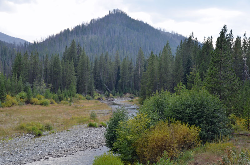
We got kind of set up at Fishing Bridge CG (including increasing our stay to four nights), and then headed east to the Eastern Entrance and back, which is where the following photos are from.
At last the air is somewhat clearer.
Pictures follow:
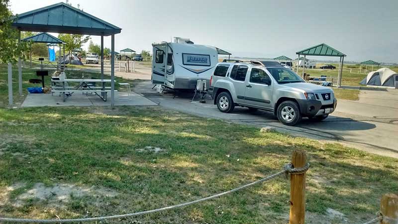
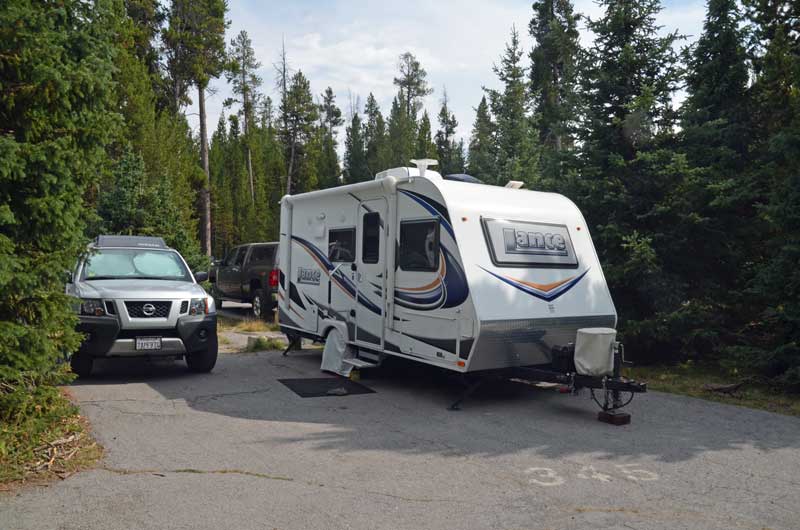 Camp site at Fishing Bridge. Although the spaces are quite cramped, it was perfectly adequate, as we spent very little time there.
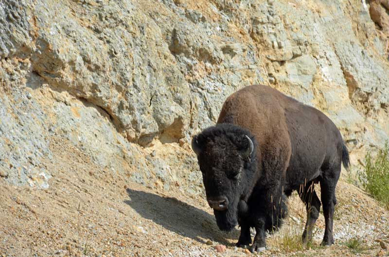 Our first wildlife photo opp., of which there would be many.
 Lake Yellowstone
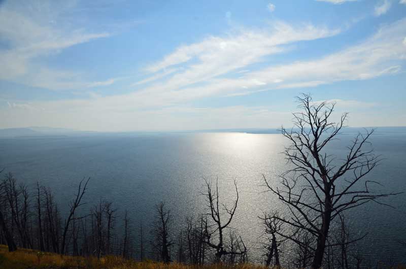
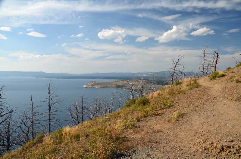 More Lake Yellowstone
Peaceful
Utah Lake State Campground
20th-22nd August 2015
If you like power boats, sailing or fishing, this is the place for you. We liked it, and we don’t currently do any of those activities.
The campground is clean, the sites well separated, each with a huge canopy, power and water, lots of of green space.
Anyhoo, we’ve sojourned here for three days, and it’s been just great to do nothing very much at all. There’s still a lot of smoke about, but the wind is blowing, so it might be better tomorrow. Isn’t that always the way?
Next up, a big surprise, for us, anyway.
Pictures follow:
Our site: A 20. Lots of shade trees in the afternoon

Pretty scene of the river that feeds the lake.
Grand Escalante Staircase & Capitol Reef National Monument
19th August 2015
Grand Escalante Staircase? Isn’t an Escalante a staircase? We weren’t aware, but this description refers to the whole huge area that encompasses all of the National Parks we’ve been in, but also pretty much all the others, too. So driving along Hwy 12 through the town of Escalante does not constitute ‘climbing the staircase’.
That said, it was all pretty lovely, especially ‘Hells Backbone’ which I’d love to ride on a motorcycle some day.
The big downside was that the smoke smog had got thicker, and it was literally impossible to see features more than 500 feet distant. As we travelled 12, it should have been possible to see huge valleys and hills, but not for us, not that day.
Having been advised to eat at the ‘Hell’s Backbone Grill’ in Boulder, we did. It was not a promising start: There was big hammering and construction of shelves in the dining room, the a/c was turned down to arctic, and the food took ages to arrive. The hammering stopped, the temps didn’t change and the food arrived, and it was good. A simple breakfast with a couple of eggs, a couple of potato cakes and an elk sausage with toast shared between us, but beautifully prepared, seasoned, herbed and presented. But, $4.00 each for glasses of not even freshly squeezed orange juice! Oh well.
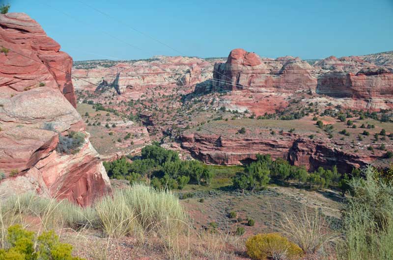
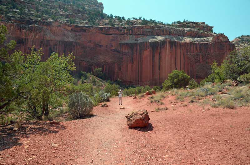
Continuing on, we came to the end of Hwy 12, turned right and were shortly at the entrance to Capitol Reef National Monument. Yup, more red rocks. We were pretty close to being ‘rocked out’, but hey, it’s all good.
It turns out that this canyon was, for a very long time, used by folks to get to Arizona – which is quite amazing considering that it is subject to flash floods and very sticky mud.
Wondering whether it would be too late to comfortably get back to the trailer, we ‘punched in’ its address in Cedar City, and although we’d traveled well over 400 miles in the last couple of days, it was only 150 or so to get back. 150 or so of the most unutterably boring driving along Hwy’s 24 and 62. Why is hwy 62 even there? There’s nowhere it goes or comes from.
After a Starbucks call, a bit of shopping, fill up with gas, back to the campground and our little trailer that we are calling ‘home’ for the next few weeks. Utterly exhausted, we microwaved a freezer ‘seafood medley’ (which was delicious), had a glass of wine, and relaxed.
Pictures follow:
 Scene from Hwy 12

You might not think so, but this is an astonishing shot (by B, with her amazing Canon super zoom point and shooty thing) of an Anasazi granary, way high up on the cliff side along Hwy 12. I looked, and I couldn’t see it. The Belgian family who showed up looked and they couldn’t see it. B knows about these things and spotted it, turned the zoom to +11 and got it. Bravo!
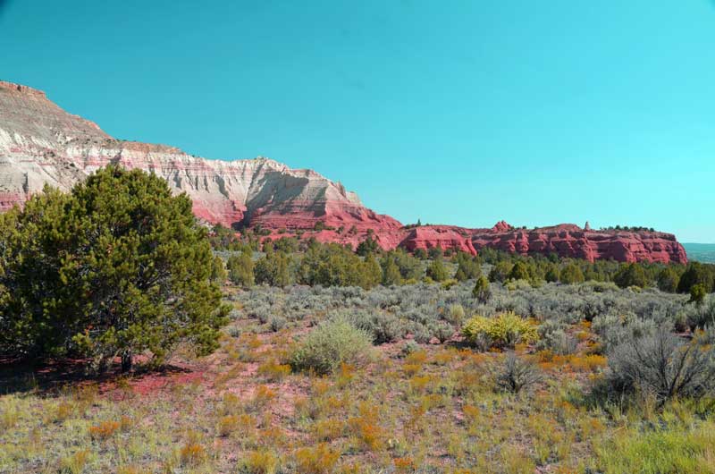
 Capitol Reef
 Capitol Reef
 Capitol Reef
 B taking a photo of me whilst…. Capitol Reef
Bryce Canyon & Kodachrome Basin State Park
Tuesday 18th August
Bryce Canyon
Even though it was only 50 miles as the crow flies from the campground, by the time we’d followed the GPS ‘quickest’ route north on I-15, south east on 20 and then south on 89, it was well over a 100 miles to get to Bryce Canyon. Even so, we were earlier than most, and the crowds weren’t too bad at all until much later in the day.
What can be said about Bryce Canyon that hasn’t been more elegantly by others. It’s mile upon mile of reddish eroded sandstone, where the wind and rain, over geological time, has carved fantastical structures. A bit like the Grand Canyon when first encountered, it’s all too difficult to see in in three dimensions, and looks ‘flat’ like a painting. But it’s not, the amazing vista, on a clear day*, can reach up to a 100 miles or so (* today, it didn’t as smoke from the California and Idaho fires really limited the view).
Between us, B and I took well over 200 photos. The few that follow are just a selection that caught our eye. I really wish that I’d brought the 10-20 mm wide angle lens, as the vista was so wide that it couldn’t be caught (not even close) with the 15 mm widest angle of the main lens.
Pictures follow:
 This photo gives a really limited view of the scale of the place

 Kodachrome Basin State Park
We saw this place marked on the map and were curious. So, after we found accommodations at the excellent Bybee’s Stepping Stone Motel in Tropic, UT, we headed out to take a look. After all the earlier eye-candy, this place seems modest, but if viewed before Bryce Canyon, it would seem outstanding – a lot of eroded vertical stone structures, and, a campground in a fantastic and quiet setting. If we ever get back to this part of the world, this is a place we’d like to stay.

Cedar Breaks & Parowan Gap Petroglyphs
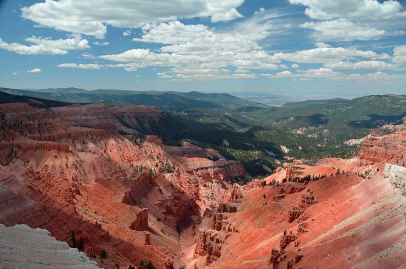
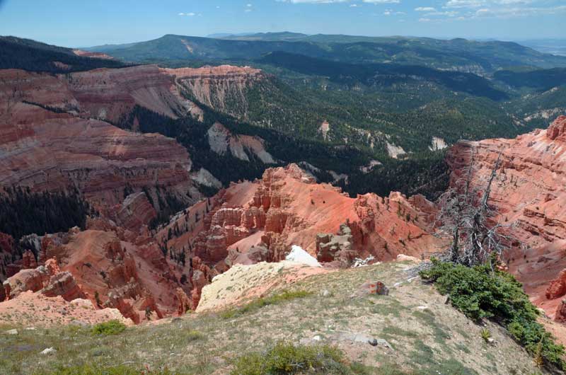
I (Simon) had never heard of Cedar Breaks NM. It looked pretty close to Cedar City, where we are staying, so we thought, why not?
We’re really pleased we did, as it’s an amazing ‘tear’ or ‘break’ in the landscape about 10,000 feet above sea level. Getting up that high from Cedar City proved interesting on Hwy 14 – twist and up, twist and up, with certain death in case of a driving error or blow-out. Temps were in the high 60’s (compared to mid 80’s down the hill) and jackets were worn.
We rolled down the hill through Brians Head, and down into Parowan. B piped up, ‘Why don’t we look for the Petroglyphs?’, ‘Why not?’, sez I.
The map we had was more like the Tube map for London than anything you could actually navigate with, and neither the Garmin GPS nor the Google maps knew anything about the ‘Petroglyphs. So, I winged it, and ended up on a dirt road, dust flying. Eventually, on ‘Gap Road’ (should have been a clue) . Google maps decided to announce our arrival about 5 miles too early, and the Garmin feigned complete ignorance. We passed the ‘Dinosaur Tracks’ (Really?) and eventually came across the place. Also pretty amazing, in a different way.
Pictures follow:
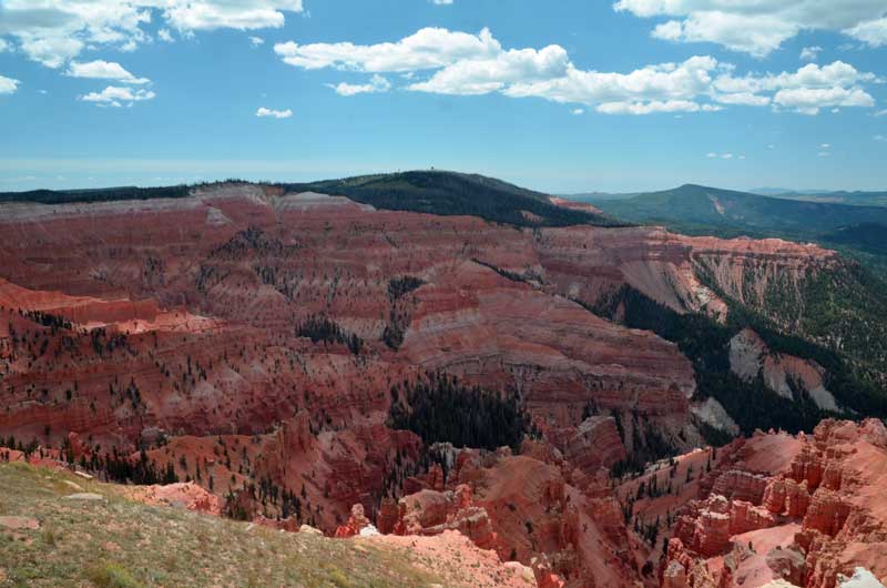
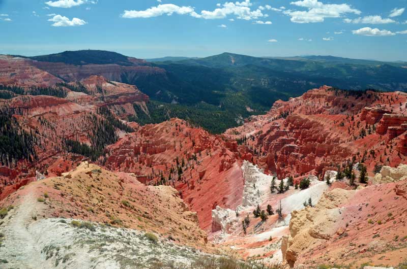
Cedar Breaks
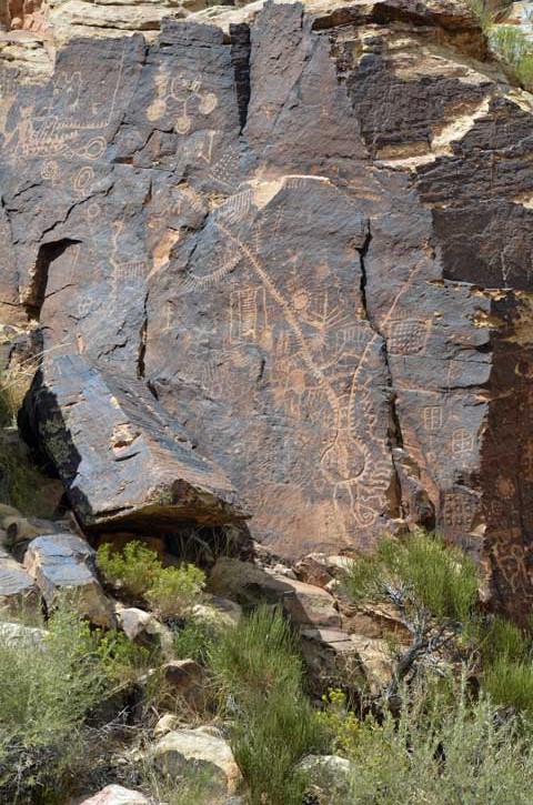
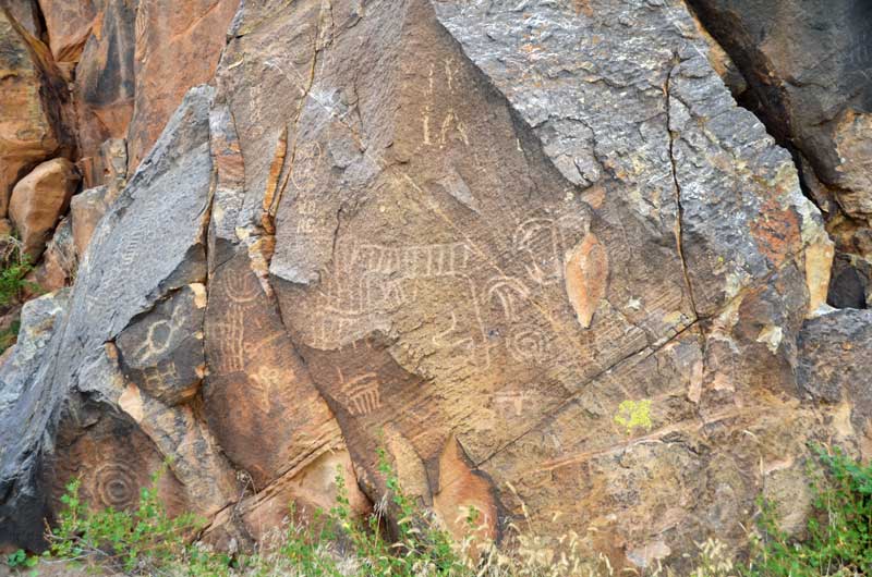
Parowan Gap Petroglyphs
This petroglyph was probably the most striking. It depicts (apparently) a tribe leader who was killed in battle. You can tell he was killed as i) he’s upside down and ii) he has an arrow through his head.
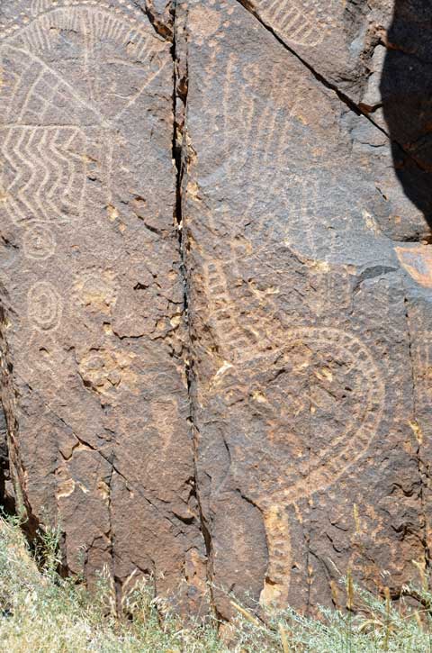
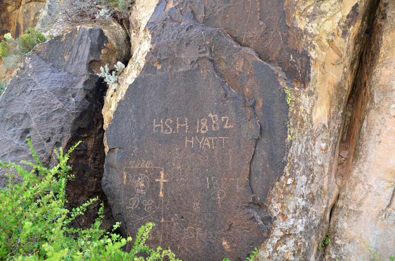
Petroglyph or vandalism? The Mormon explorers came through here on their way to set up the town of Parowan, and left their mark.
Red Rock Canyon & Mt. Charleston
Falling off the mountains down into the Mojave desert floor, it seemed to get hotter and hotter, even though we couldn’t tell, we had the a/c on.
We arrived at our destination in Las Vegas, the Riviera RV Park, on the east side of town. A bit run down, but ‘workmanlike’, it was plenty adequate for what we wanted – somewhere to take a break from driving, and to see some local geology.
But it was hot, 110 degrees hot. The trailer’s 13.5 kbtu couldn’t keep up with it, but it was tolerable at 85 or so. Outside it was an inferno.
Next day – 15th August, we set off for Red Rock Canyon, on the west side of town. Oh my, the traffic lights in Las Vegas take an …..a…….g…….e to change (and why is it always red for us and green for the other guys?).
Let’s just say this, compared to Las Vegas, Red Rock Canyon is just charming and wonderful. Not the hugest, biggest vistas in the world, but a little bit of a break from the heat and very eye-friendly.
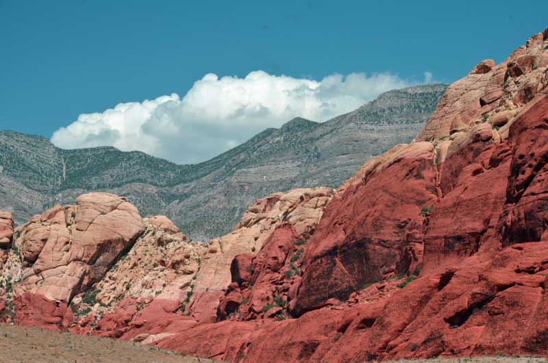
The eponymous red rocks. In the background is the older grey rock.

The ‘side-thrust’ fault can be seen in this image, where the newer red rock is under the older grey rock. Geology is fun!
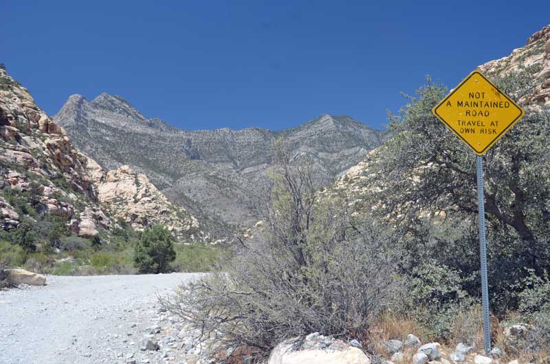
Up at the very top of the canyon was this dirt road heading up and over the hills to the other side. Yep, we’re wimps.
 There was this climber who seemed to get a panic attack climbing down this face. He took ages to regain confidence, and was last seen hanging in free air just below where he is in the photo, slowly letting himself down. Phew!

B’s money shot, right by her open car window.

Mt.Charleston was so high that all our pictures of the valley below were so hazy that Photoshop could do nothing with them. This one is kind of pretty, but gives no idea of the scale of the place. And it was cool – 70 degrees or so. There’s a neat campground up here too. No 40 footers, though.
Holcomb Valley
Thursday 13th August. Still at Serrano cg, Big Bear, we took a short hike to Big Bear Discovery Center, where we discovered a number of things:
That the ‘movie’ that was on repeat, describing what was outside the center was the lowest ‘fi’ grainy ‘remastered in 2007’ Ken Burns special (a lot of zooming around low quality still photos). The cognitive dissonance hit you in the face when you stepped outside the center.
That it would have been an even shorter hike if we had walked up the road, instead of the very pretty marked trail.
That there was a gold rush a few miles north of here about the same time as the other gold rushes were happening in California, and that there is a network of dirt roads that lead to some remains of what went on. So we picked up the brochure for ‘Gold Fever Trail’ and that’s where we went.

This was ‘Two Gun Bill’s Saloon’. A few logs scattered around, which might or might not have fitted together at some time. Oh, and the real site of the saloon was two miles east of here.
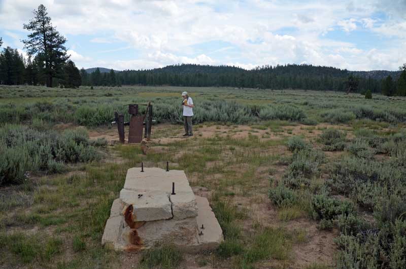
The Grasshopper Quartz Mill. What remains is apparently a water pump and part of a crushing device.

Belleville Cabin. It was ‘moved’ here to exemplify the type of cabin that would have been here if there was one here. I think it was ‘moved’ here from a place that makes cabins, as it looks like it was built last year.
Joking aside, it seems amazing that so little remains of what must have been a huge community.
The start of the ‘Grand Adventure’
B was frantically double bagging everything to protect it from the evil ‘sulphuryl fluoride’, the stuff they use to fumigate against termites. It turns out that we are such pack-rats that we had more than a dozen ‘double bags’ of stuff, for dry food, medications, freezer stuff, fridge stuff and etc. and etc.
This fumigation is due to happen some time in mid September, but we were on the point of leaving for a 6 week ‘Grand Adventure’. I’d put the Jade plant outside, as instructed, and some effing person had already purloined it. Oh well, who can you trust?
Anyway, B got it all done, and I loaded the trailer and tow vehicle. Time to pull out all the wall-warts and shut down the computers. Uh-oh, Micro$oft had decided to update my desktop, and shutting it down was taking f o r e v e r. Screw that, just hit the ‘Off’ button for a few seconds, worry about it when we get back.
So, off we set, up the I-15, only to realize that we hadn’t put on our new Aero 2 extension mirrors. Pull over to hwy 395 and the entrance to the Lawrence Welk resort(!) and fix that. Turns out that these mirror extensions are the bees knees – now I can see who is right behind me.
Ponder Nessy Burgers for lunch, but then decide to drive through to our destination – Serrano campground at Big Bear Lake.
Mostly uneventful, except for a weird sway overtaking another travel trailer at 55 mph on the 215. I brought it under control by hitting the manual brake control for the trailer brakes, but there was some considerable ‘pucker factor’.
We were impressed that the Xterra pulled like a trojan up the 330/18. Coolant temps stayed low, and we sort of kept up with traffic.
The campground is just fine

and an easy walk to the lake

Sierra Nevada – traveling up the West side and down the East side
The 13th April, an auspicious day, marked the start of our Sierra Nevada adventure. Why? Because I (S) had toe surgery planned for the end of May, which would cause me to be ‘un-trailered’ for at least 12 weeks, and like the soccer guys, wanted to ‘get my retaliation in first’, and this was the last opportunity to go.
There will be more pictures than text, but some amount of preamble might be fun.
There wasn’t too much planning. We decided that the first night would be at California Hot Springs, and then we would just wing it thereafter. Why there? Because we’d done Lake Isabella multiple times, and this was a different launch point.
We set off, for us, early, at 9am, from San Diego and headed up the I-15, hoping to avoid the crush on I-5, I-405 and the prelude to the Grapevine. Um, no. The 210 was a parking lot, grrr, and on the Grapevine ‘up bits’ we overtook all the laboring commercial traffic, and down the ‘down bits’ they overtook us, so it was a kind of a motoring ballet dance.
Eventually, we filtered off onto CA-99, which was much less intense, then headed east up into them there hills to California Hot Springs.
We had already decided to stay at Quail Valley ‘Recreation Village’ rather than at the Hot Springs resort, which turned out to be a good choice as that latter was closed for RV’s.
Myron, the owner, was a hoot, regaling us with tales of the misdeeds of his long term residents, and his ‘innocent’ retaliation. In one instance, he suspected that a long-timer was stealing his gas. Long story short, he swapped the gas cans for ones with water in. The next day, the long-timer’s car wouldn’t start. L-T’s pals did stuff with the points and carburetor. Myron wandered over and casually asked whether L-T had stolen some of his gas. L-T exploded with indignation. Myron shrugged, and remarked that he’d moved the gas cans and the ones there were now water. Next day, L-T was observed draining his gas tank and lines and didn’t stay much longer at the park.
We were the only transients there. Really pretty, we stayed a couple of nights.
 Next morning, we set off up the hill into the mist and fog. Around the intersection with the road up from Lake Isabella, we encountered a pair of very damp and cold looking Harley riders, apparently undecided about which direction to go. Then the sun came out (or we got above the fog?)
Stopping briefly at the ‘Trail of a Hundred Giants’ for a photo op (we’d walked the trail before),
 we headed on through the forest. Like almost the entire trip, it is picturesque, almost beyond belief.
 Starting around Ponderosa, the road starts winding down towards Springville in the Central Valley. If there are any motorcyclists here who have ridden the Palomar South Grade, then this road is like that, but it just goes on, and on, and on, and on.
 Later, when we returned to Quail Valley, we took a hike around the property, and came across 4 fishing ponds, of which B got a couple of very pretty shots.

 Next day, we took it really easy. We drove a mere 75 miles to Horse Creek Campground, right by Lake Kaweah. This once was an Army barracks, but is now an extremely pretty lakeside cg hosted by the Army Corps of Engineers. No hookups, but loads of space – if you don’t like your neighbor, you can just move.
The live-in volunteer camp host was great, and tried to recruit me (S) to come and work there.
Because we have a national Parks Geezer Pass™, it only costs $10 per night.


 Simon, cooking.
 Next day, we set off up the hill into the Sequoia National Park, and Kings Canyon NP, returning via an extension of the Sequoia National Forest.
Again, the ‘Geezer Pass’ saved us $20. I, Simon, probably had a brain fart when I first ‘did’ this park in the last Millennium, because what I remember is completely different from what we experienced. Nonetheless, it was all good. We had fun joshing with the volunteer at the visitor center and did quite a bit of hiking up and down the trails. A side trip into Kings Canyon NP added to the pleasure.


 King’s Canyon
 On the way back to Horse Creek campground, we diverted via ‘Hogback Road’. Oh my. That is all. Talk about wild rides. Good job we didn’t have the trailer on the back.
Next day we decamped and headed for Gold Country. We decided to veer from the GPS proposed course up Hwy 99 and headed North on 41. Then, the weirdest thing happened, the GPS insisted on telling us to ‘GO BACK’ to 99, and that it would take ‘FOREVER’ to get to our destination if we didn’t, until we got within a couple of miles from Mariposa, when it said, ‘OK, then, if that’s how you want to play this, you’ve just saved two hours!’ WTF?
We got a bit snarled up in Jamestown after having visited the local Safeway for supplies, but soon enough we arrived at our destination in San Andreas – Gold Strike Village. Big shout out for this place, it’s clean and well-tended. The only problem I encountered was that our neighbor’s water hookup leaked, and I was attacked by mosquitoes as a result when I was preparing a meal on our outside grill.
Next day we headed South back to Jamestown, and it turned out that they were having a wild flower run on the local RailTown steam railway. B is always up for steam trains.

 We had to pay extra for this trip as it was a ‘Wildflower Special’, but sadly, there were not many wildflowers around – too dry, too late. One of the state park rangers on the train’s spouse planted some plastic wildflowers…
 And there were other treats..


 Columbia State Park is fun

After three nights in Gold Country, it was time to head out. Up SR49 to Placerville and SR 50 over the top and down the other side to Lake Tahoe. That’s a wonderfully pretty drive, and no problem with a trailer. We encountered an utter jerk who was holding up dozens of others in anticipation of finding a parking spot near the lake, but some folks are resistant to education and learning good manners.
We headed east to Hwy 395 and trundled south through some spectacular country…
 …to arrive at Lee Vining and eye-wateringly spectacularly high gas prices. And wind. Did I say wind?
Next day we headed south to Bishop and the Law museum. Oh my, this is a wonderful place to get an understanding of history hereabouts. Billed as a railway museum, it seems more to document the mining and general way of living hereabouts, with the railway almost as a side comment.

 To Lone Pine, and Boulder Creek RV Park. A lot has been posted about this place at the Lance Owner’s of America Website , and who are we to disagree.
Alabama Hills and Whitney Portal


 Postscript: I deferred the surgery, so I’m still, slightly, on two feet. And raring to go for our next adventure.
Corny
 Corn is what (amongst other things, including a bell pepper similarly home grown) we ate tonight. They tasted yummee, and only took about 70 days to mature from seedlings. The darn things are trying to push the roof off our raised bed garden.
In other news, my Nexus 4 developed a crack across the back of the phone: 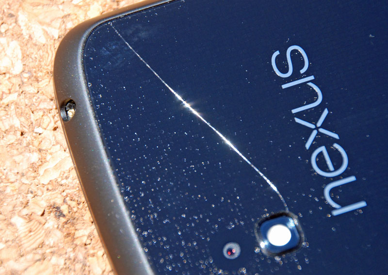 I hadn’t dropped it on any hard surface, and it has always been in the ‘official’ bumper case. Anyhow, I shipped it back to LG in Texas, and just over 2 weeks later, a replacement phone arrived. It has to be noted that if it had been an Apple product, all I would have had to have done is take the faulty one to an Apple store and it would have been replaced and activated there and then. But anyway, for the most part, the Google backup system works just fine and all my apps and data were restored in a couple of hours.
I like it. It’s nice to be positive about stuff 🙂

You must be logged in to post a comment.