Cedar Breaks & Parowan Gap Petroglyphs
I (Simon) had never heard of Cedar Breaks NM. It looked pretty close to Cedar City, where we are staying, so we thought, why not?
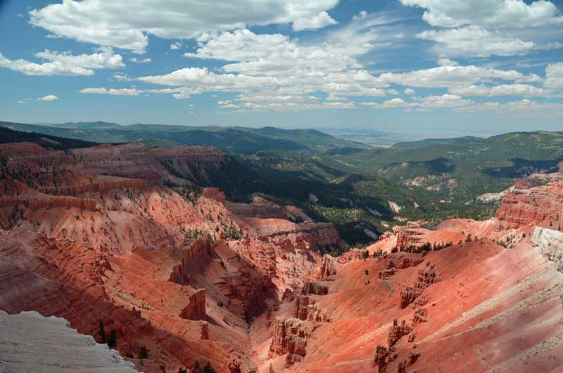
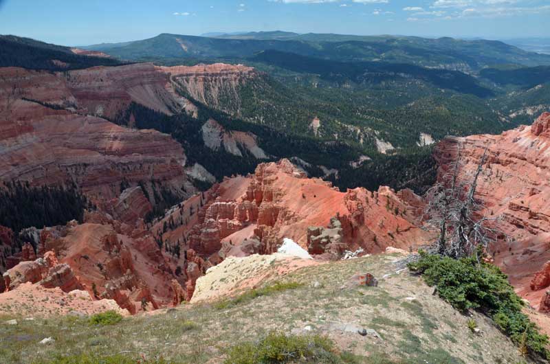
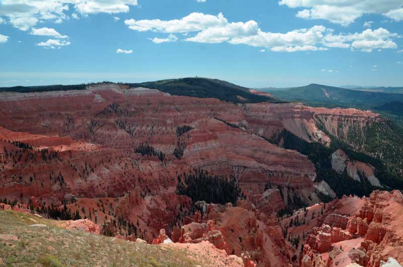
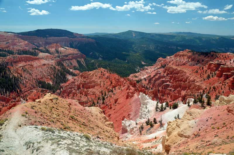
We’re really pleased we did, as it’s an amazing ‘tear’ or ‘break’ in the landscape about 10,000 feet above sea level. Getting up that high from Cedar City proved interesting on Hwy 14 – twist and up, twist and up, with certain death in case of a driving error or blow-out. Temps were in the high 60’s (compared to mid 80’s down the hill) and jackets were worn.
We rolled down the hill through Brians Head, and down into Parowan. B piped up, ‘Why don’t we look for the Petroglyphs?’, ‘Why not?’, sez I.
The map we had was more like the Tube map for London than anything you could actually navigate with, and neither the Garmin GPS nor the Google maps knew anything about the ‘Petroglyphs. So, I winged it, and ended up on a dirt road, dust flying. Eventually, on ‘Gap Road’ (should have been a clue) . Google maps decided to announce our arrival about 5 miles too early, and the Garmin feigned complete ignorance. We passed the ‘Dinosaur Tracks’ (Really?) and eventually came across the place. Also pretty amazing, in a different way.
Pictures follow:
Cedar Breaks
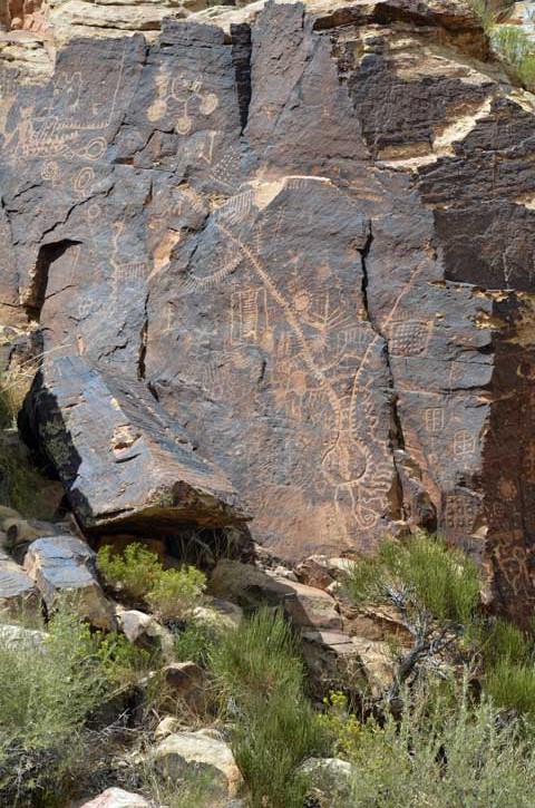
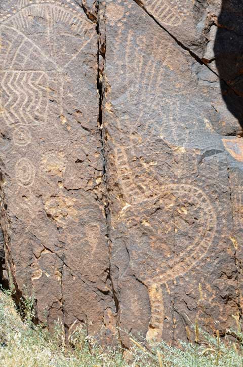
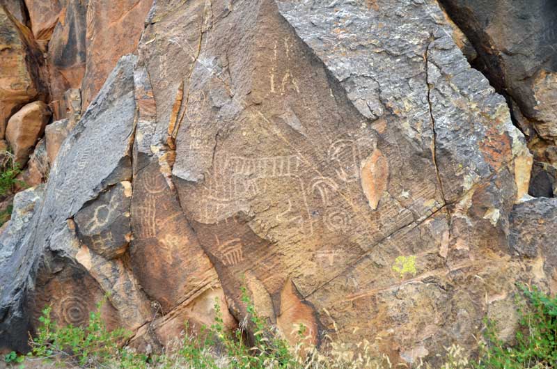
Parowan Gap Petroglyphs
This petroglyph was probably the most striking. It depicts (apparently) a tribe leader who was killed in battle. You can tell he was killed as i) he’s upside down and ii) he has an arrow through his head.
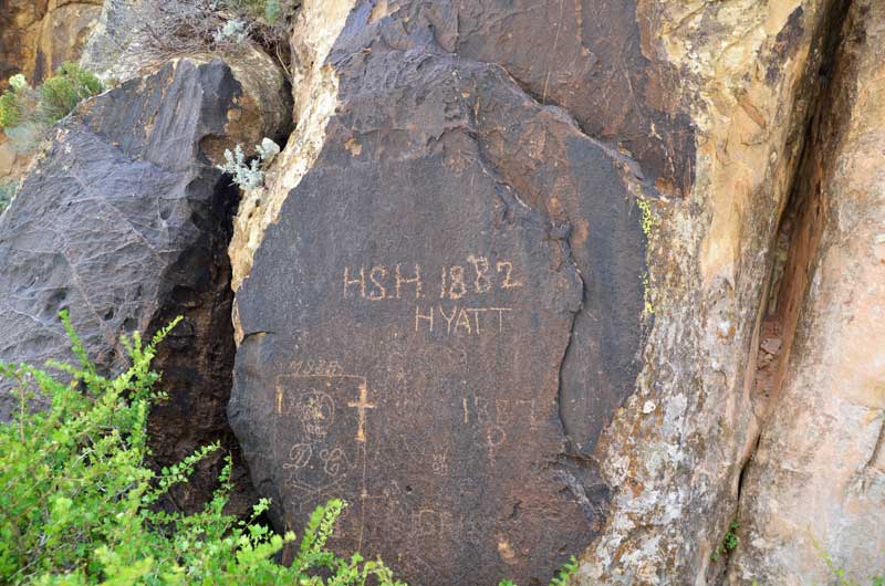
Petroglyph or vandalism? The Mormon explorers came through here on their way to set up the town of Parowan, and left their mark.

You must be logged in to post a comment.