Baja Trip. Wrap Up
We drove just over 3000 miles. This on a peninsular that’s only 900 miles long. Side trips, loads of them, are the difference. Fuel ‘economy’ was a smidgeon under 15 mpg, which in fact is remarkably good for this vehicle, in our experience. The average cost per gallon in Mexico turned out to be US$3.65 and that’s for Magna (87 octane). We had no issues with anyone trying to ‘cheat’ us in any way on gas (or any other transaction, for that matter).
Money and exchange rates. We can’t prove it, but it seemed that paying in US$ got us a worse exchange rate than getting pesos from the ATM at a bank and paying in local currency. The bank with the ATM and our credit union in the USA take a bite out of the ATM transaction, but even so it seemed to be in our favor.
Despite the fact that we’ve done the same Spanish language classes (level 1 & 2) three times at our local adult education scheme, we still were absolutely hopeless with the lingo. It began to start ‘coming back’ to us after the second week, but really slowly. The only excuse we have is that we are old. Despite this, we always managed to figure out with the Spanish-only speakers what it was they wanted/we wanted, because they really try to work with you.
There are Walmarts in Tijuana, Mexicali, Rosarito and Ensenada. OK, but who knew there is a Walmart Supercenter in La Paz. Plus, the Bodega Aurrera chain is owned by Walmart (and has Walmart WiFi).
We took enough clothes for 7 days. We found that laundromats are widely available, and ‘servicio’ (service washes) are frequently available and cheap. B broke out with livid rashes on her face and hands, which could be due to whatever laundry chemicals that had been used on our service washes/hotel bedding. Next time, we’ll be sure to use our own low allergy laundry liquid, and try and avoid hotels (or, bring our own pillowcase since B’s rash wasn’t all over).
Sirius/XM Radio works just fine. Except, in our case when you get as far south as La Paz, and then it’s just useless. The ‘techie’ in me thinks that the satellite signal is ‘focussed’ on the USA, and you just run out of ‘edge’ signal, that far south.
Wifi/Cellular data is ubiquitous. Where people are ubiquitous. Otherwise, it’s non-existent. That seems reasonable. We got an AT&T pre-paid SIM for one of our phones, and we were able to roam on TELMEX almost everywhere in the towns and cities along Mex 1. It was mostly HSPA, except in La Paz, where we had LTE. We got nothing in Bahia de Los Angeles. Most hotels had some form of WiFi. On average, the WiFi wasn’t too bad, sometimes exceptional, sometimes, just useless. Even Rancho Meling had WiFi, sort of.
Google Maps vs Garmin. For ever, we have found that Google Maps is a great way to run your phone’s battery down, without offering much more than Garmin GPS does. And Garmin, because it’s satellite based, is available everywhere, unlike the cellular data based Google Maps. This changes in Baja. The actual maps are pretty much like for like, but what Google Maps knows about restaurants and places to visit, and so on and so on, way outstrips the limited information that Garmin has in its database.
Finally, we rediscovered that the people in Baja California are honest, hard-working and charming. I’m certain that there are bad apples, but we didn’t encounter a single one.
Baja Trip. Episode 15
It was so windy last night that the pilot light for our water heater had blown out, so cold shower. B’s face was slightly worse, so we stopped by a pharmacy to get some anti-allergy potion. Too early to determine whether it’s making a difference.
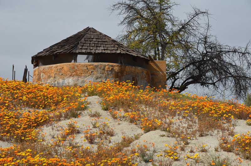
40 miles north of San Quintin, we made the eastern turn towards San Pedro Martir. Everything is so green from the recent rain, and it all looks so pastoral, not at all like the Baja we thought we knew. Eventually we start seriously gaining elevation and the scenery around us becomes a riot of yellow, orange and purple wild flowers.

At around 20 miles, we see the road down to Rancho Meling, which is where we’ll be staying later, but on up the road we go, the temperature dropping as we climb. We start seeing pockets of snow at the side of the road, and then the road goes crazy – switchbacks and hairpin turns. Eventually we get to to the entrance to the park – Parque Nacional Sierra de San Pedro Martir – and we’re up to our ankles in snow

We continue past the museum all the way to the locked gates of the observatory, at about 60 miles from Mex 1. There was a small line of vehicles in line waiting, so we can only assume that they open at some time. We hadn’t made any arrangements to visit the observatory, but it’s pretty high up and cold here – about 8,550 feet.

We turned around and started to come off the mountain, stopped by the museum, which, for some reason, had all its doors open, making it rather chilly. Further down the hill, we made the left turn onto the dusty dirt road heading to Rancho Meling, and checked in. Er hem, electricity only between 5 and 9 pm, light your own wood-burning stove in your room, and your own kerosene lamps. Can you say rustic? Not really, the place has a huge satellite dish (not for us, no tv in our room), and WiFi, if you choose to sit next to its antenna. It’s to be a communal chicken meal tonight.
This place is, quite literally, in the middle of nowhere, and it is beautifully maintained. The gardeners are at work outside our door as I write this. The hill behind our room:
I joined the communal dinner (without B, who felt indisposed), and happened to sit next to the owner, David Lang. That was wonderfully informative about the history of the ranch, and made me feel very special.
Today, Sunday, the clocks changed, and so did we. We decided to head back home because poor B’s IBS and rash were not making her life too enjoyable. All went well except for a 100 minute wait to cross the border at Tecate, and my, those border folks are brusque, don’t they realize that the taxes I pay, pay their salary?
I’ll do a wrap up post with facts and figures about this trip, next.
And we’re planning a trip to San Felipe, very, very soon.
Baja Trip. Episode 14
Well, everything (except one) worked out today. The ATM gave us some cash (Yay!), we got needed supplies and our resting point for the night (Don Eddie’s Landing in San Quintin) is in a lovely setting, and we have some great views from our room (the honeymoon suite).
What didn’t work out is that B has a rash on her face, and it’s making her feel weird.
Photos from hereabouts:


Baja Trip. Episode 13
13 is a good number, not.
Today is Friday.
On Tuesday, we left Mulege, and looked at the motel options in Vizcaino, settled on one, and then set off back along the road to try to see Mission San Francisco de la Sierra. We got about 20 km along a paved road that went way up high in the hills until it fizzled out into a bright red mud dirt road. No way were we going to drive along that. Back we went.
Wednesday, after overnighting in Vizcaino, we took the road to Bahia Tortugas. It’s a long road, with not much to look at. When we got to our destination, we felt that it was a place with a great future behind it. So, we drove back and stayed at the Halfway Inn (no joke) on the 28th parallel just north of Guerrero Negro. From the hotel, one can see that the old Federales checkpoint has lost both its huge ironwork eagle and its huge Mexican flag. What’s up with that?
The bank (Bancomer) ATM refused to let us have any pesos – the same ATM that gave us some, last time through.
Thursday, we had decided to spend a couple of nights at Bahia De Los Angeles. It turned out not to be, as all the hotels were booked for some racing event. Filled up with gas at the local Pemex – they wouldn’t take a credit card, thus eating into our dwindling pesos at $4.50 a gallon! Back we tracked to Mex 1 and pulled off at the La Pinta hotel at Catavina. $70 a night and 30 pesos an hour for wifi. No cell signal. Got us by the short and curlies. But, oh well, at least they take credit cards 🙂
We shelled out the 30 pesos, and at least got ourselves places to stay for Friday and Saturday.
Later, the day redeemed itself, somewhat, as the food in the hotel restaurant was delicious. B had enchiladas de camarones and I had tacos barbacoa.
Today, Friday morning, we turned off Mex 1 to take a look at the old marble mine – El Marmol – and got about 1 km along the dirt road only to calculate that the 30 km return journey would take us more than 2 hours at our current rate of progress. We weren’t that interested in a non-working marble mine.
Looking forward to episode 14, as numero 13 wasn’t a whole lot of fun.
Baja Trip. Episode 12
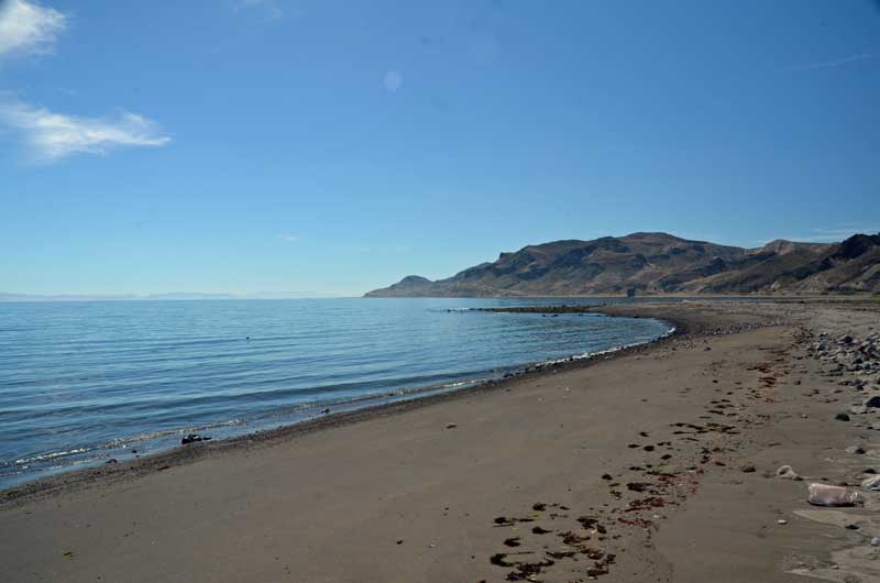
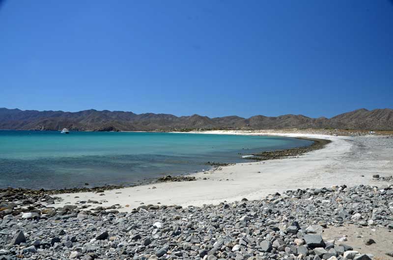
Unrushed day, today, driving north from Ciudad Constitucion to Mulege.
On the way we stopped to admire the geology:

Bahia Concepcion – yes, the water is that blue:

and wandered down to the Isla el Requeson:

Baja Trip. Episode 11
Here is the famous La Paz Dove (see B in inset for scale). Yep, everyone has a photo of this. This is ours.

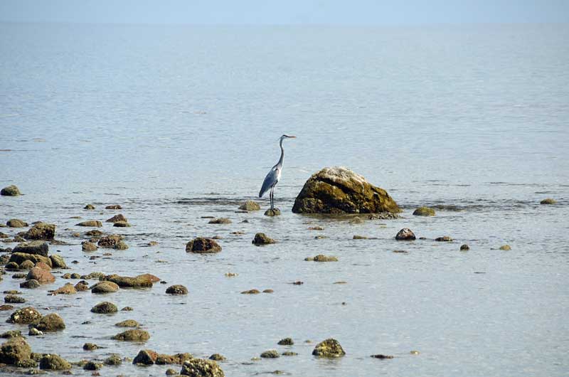
We had a gentle and moderately twisty drive north west around the bay this morning. Here are some images from San Juan De La Costa:
Baja Trip. Episode 10
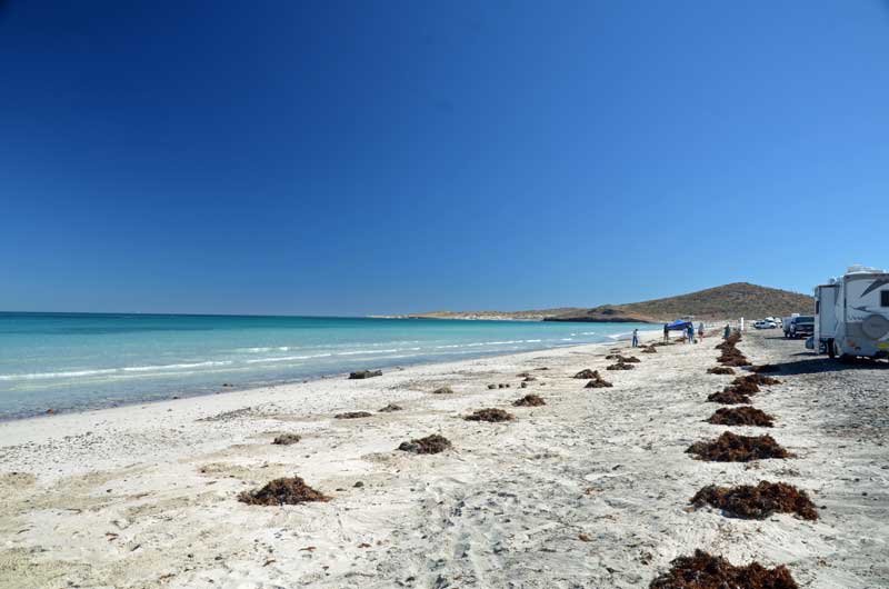
B writes: This morning we set off north of La Paz to see Playa Tecolote. Having overcome one stretch of construction and a rather confusing junction, we arrived at one of the many beautiful beaches along the Sea of Cortez. The water was unbelievably clear! There’s a section of beach where you can rent a palapa (shade structure), and farther out a stretch of beach that appears to be completely free for boondocking.
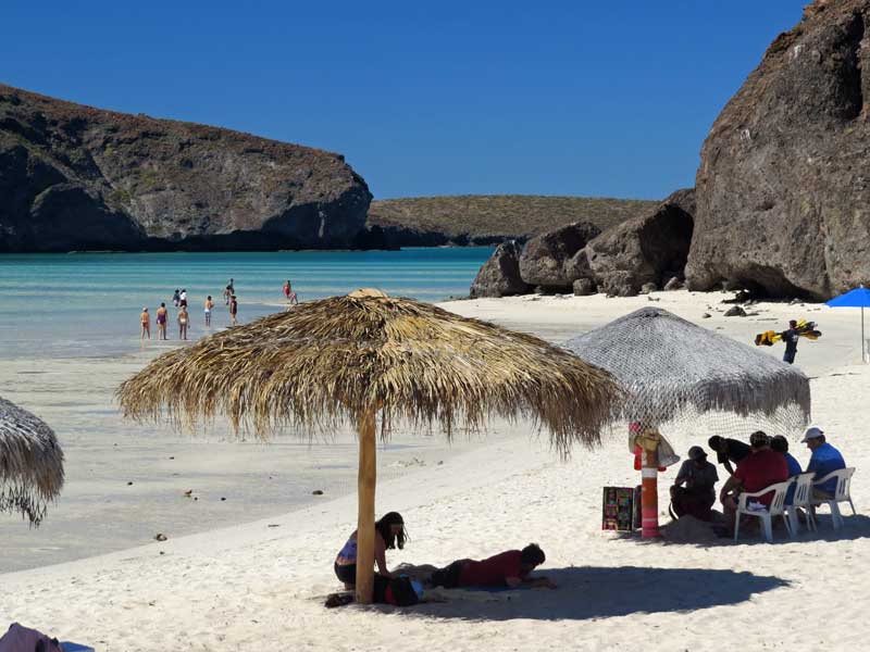
Next we headed back south, with a short detour west to Bahia Balandra. It was quite popular, probably because there was a small lake (or maybe a lagoon) that was, at its deepest, about waist deep. Lots of families here.
Continuing south then eastward, we went to see Ensenada de los Muertos, located on the Bahia de los Suenos (there should be a tilde over the ‘n’). B noted the possible Hamlet reference ( . . . to sleep, perchance to dream . . . ) but we have no idea if that’s real. The modest Bahia de los Suenos beach club is here. It seems to be mostly a beach restaurant. We ate our picnic lunch here instead.
Came back to our centrally located hotel to find no street parking. No problem – there’s a pay parking lot nearby. We drove in and – they speak virtually no English and our Spanish is not at all sufficient. We wanted to park tonight, take the van out tomorrow, and return tomorrow night. They couldn’t decide how much to charge us. They kept on changing the amount (mostly upward) until we finally agreed on an amount. (Later that afternoon, they asked for yet more money; we said no.)
After a short rest at our hotel, we set out to walk to the Cathedral. Our timing turned out to be almost perfect, because a wedding had just finished so we could peek in to the cathedral, and watch the wedding party take some last-minute photos in front of the cathedral.


From there we walked a few blocks farther to the Regional Museum of Anthropology and History. Again, the host spoke no English, but combined with our insufficient Spanish we managed to understand each other. And from his genial response to some of Simon’s comments, I think he spoke a bit more English than he admitted to. There was a photo exhibit with some striking photos depicting life in Baja California Sur, along with words on the wall that seemed to be an ode to the state (best B could make out). The rest of the museum depicts the human settlement of Baja California starting with humans crossing the frozen/lowered Bering Straits and migrating southward. It showed how the people survived off the land, organized into bands. First, when the peninsula was forested and verdant and had plentiful animals the people were hunter/gatherers. As the peninsula became drier and turned into a desert, the bands chose a region and lived as best they could, using the sea to augment their lives. It described the importance of the shamans, who kept the knowledge of how to survive as well as how to heal. It described the arrival of the Jesuits to the peninsula and how they overlapped the time of the shamans.
Baja Trip. Episode 9
Today, we drove to La Paz. With one exception there was nothing remarkable about that drive. For those who may be interested in this route, the road is generally in great shape and there’s hardly any traffic. Which makes for a relaxing time. The exception is about a kilometer section of road that’s being remade, during which one has to drive on rutted dirt.
After coming over the hill to see Bahia La Paz in front as a spectacular view, it becomes a reality that La Paz is a different place than any we’ve visited so far on this trip. It’s relatively clean and tidy, and the roads are well maintained, and, boy, is it busy and bustling! At the same time, it’s a tourist magnet, with all sorts of bauble stands set up along the malecon and city center streets. All good fun.
Our hotel, Central Bed & Breakfast, is 2 blocks from the malecon, and right in the city center, but, once in our room, it feels very relaxed and quiet.
Apart from a 6 block hike to the supermarket for supplies, and a visit to a service laundromat, we just chilled and wandered around a bit.
Tomorrow, we start exploring.
Baja Trip. Episode 8
Back north we went to the dread rough road. It was 3 miles of agony, bumping and chopping over the insanity that is this road. To add insult to injury, the three road workers cheerily waved us as we went by; and when we returned many hours later, apparently not a single iota of work had been done, and they cheerily waved us by….
But then the road got a lot, lot better, probably the best we’ve yet seen on the peninsula, with a speed limit of 110 kph.
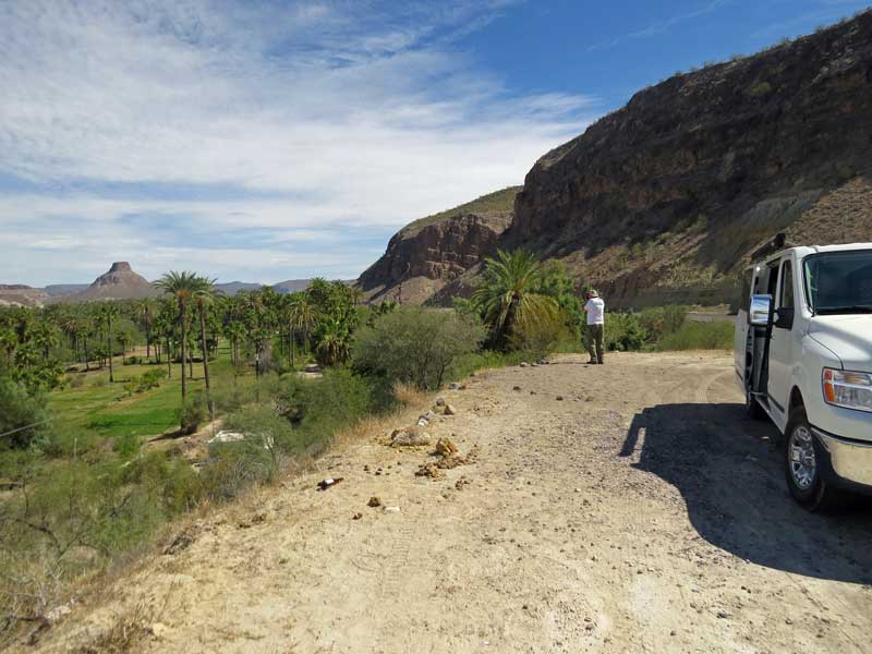
Best still, we came over the brow of a hill and there was this magical view of a blue river and palm trees and green. Coming down the hill, we had a chance to take a few photos:
B shooting from one end of the pull out…
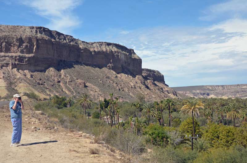 …..and me shooting from the other
Notice the horse in the next shot?

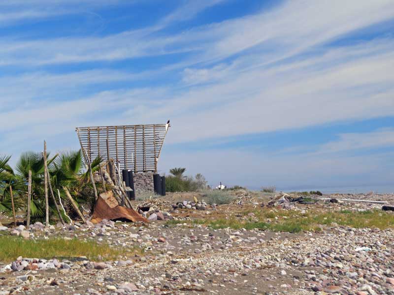
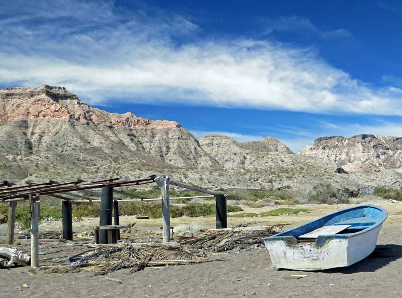
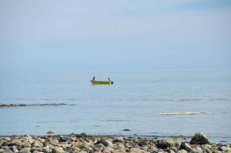
On the way back, we took a side trip over to Las Barrancas. Not much going on here, just a little fishing

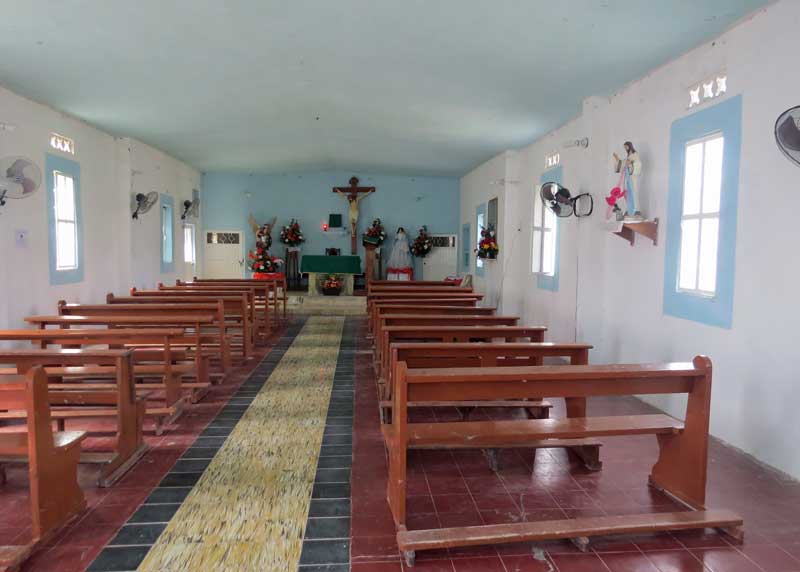
Another side trip was to San Miguel Comondu. Situated in a lush tropical canyon, it is a delightful old village, with a church

And an unusual way to move a horse around

Then back through the terrible road works, and eventually, back to the hotel, only to then set out for groceries and Chinese take-out – yummee.
Baja Trip. Episode 7
A little frustrating. We set off north to visit La Purisima Mission. We got a little north of Villa Ignazio Zaragoza, and the road – officially having promised to be paved – turned to very poorly graded and washboarded rock. I kept going for a while but it seemed like it was never going to end, so turned around and headed south again. There’s always that judgement thing, do you really want to drive through this all over again when coming back?
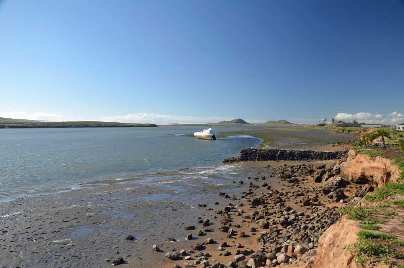
So, instead, we headed for a different location. Puerto San Carlos, which is on the coast, south of the place we visited in Episode 6. We had no idea what to expect, so adventure.
The road there was uneventful, except to discover a power generation plant in the middle of the desert. I noticed a pipeline by the side of the road, which should have been a clue. When we got to the end of the road, at the port, a security gate and guard blocked entry any further.
So we parked to take a look around, and what did we see?

A liquid natural gas pipeline terminal. Clearly feeding the power generation plant.
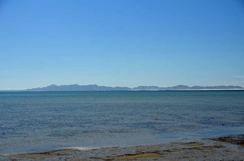
Looking west from here is near the southern end of the approximately 80 mile long barrier island complex.
Back in Ciudad Constitucion, we gassed up and got a $6 deal on 2 shrimp and 2 marlin tacos, salad and a coke. Yum.
Back at the internet, B discovered that rocky road north on the way to La Purisima was the result of bridge building activity. Google maps shows that the disruption is at most, a couple of miles long. Try again tomorrow 🙂

You must be logged in to post a comment.