Elusive Everything
31st August 2015
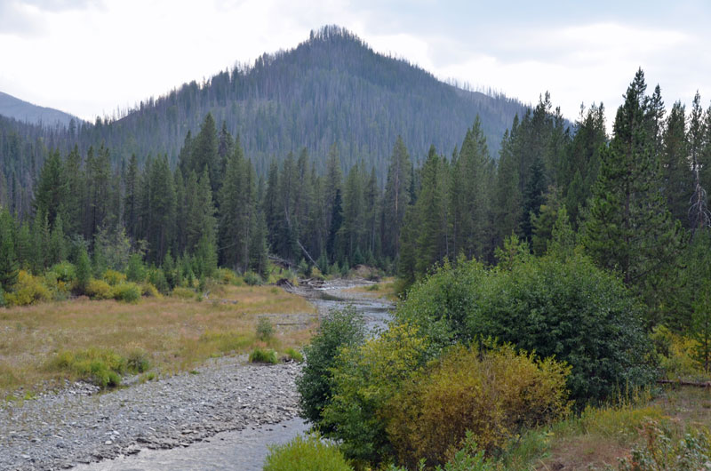
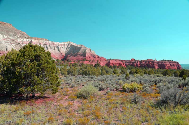
We set off to find the City of Rocks. We found the entrance to the trails but no pictographs or petroglyphs or cairns. Oh well. But we had fun hurtling across 20 miles or so of dirt roads, dust getting everywhere.
We set off to find the Ice Cave, found it, and decided that it was too darn commercial, so passed on that.
We set off to find the Mammoth Cave, and that, too, was all dressed up in silly commercialism, so we skipped that too.
Well, we washed the trailer earlier, and now she’s clean for the first time in a long time.
After all the fun not visiting places, we washed the Xterra in one of those ‘do-it-yourself’ car washes. Suds all over the place. Great 🙂
Elusive Fossils
30th August 2015
When we arrived here in Twin Falls, Idaho, yesterday, we kind of decided to chill out, get some supplies and start the local adventures today.
First off, we went for ‘Balanced Rock’. It’s a State Park. It also has a picnic and camping area which, if it had red rocks, and was well marketed, and was in Utah, would have tourists flocking to it.
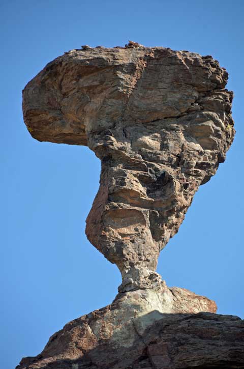 The Balanced Rock is a mile or so from the picnic place. It’s amazing. It’s tons of stone held up by this little piece of connecting stone. You’d think a slight wind gust would blow it over.
Then we went to look for the Hagerman Fossil Beds (National Monument). Er hem, this became a trail of discovery (not). The Garmin GPS was happy to find the ‘place’ for us, but insisted that we spent an hour traversing dirt roads in the middle of nowhere to get to it (note: ‘it’ is not an ‘it’, it’s a wide area of trails with no particular focus). So we ditched that and headed to the town of Hagerman, and the Fossil Visitor Center. Which was closed.
OK, 4 miles back down the road we saw the sign for the Fossil NM and the Oregon Trail, so we headed back there. Now we’re getting somewhere!
What we find is the Oregon trail, with, apparently, the original cart tracks in the hillside. A Wow! moment. The fossils, fuggetaboudit…
Then, later, we do Shoshone Falls, amazing; I.B. Perrine Bridge, what a setting; Dierkes Lake and Centennial Park, OK-ish.
 Shoshone Falls
 Shoshone Falls
 Shoshone Falls
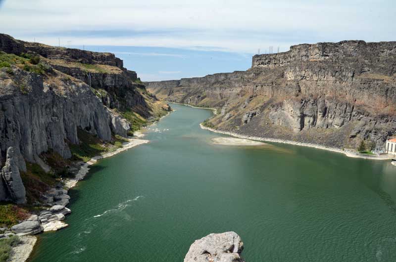 Snake River downstream of the Falls
 I.B.Perrine Bridge
 The ‘Twins’ of Twin Falls
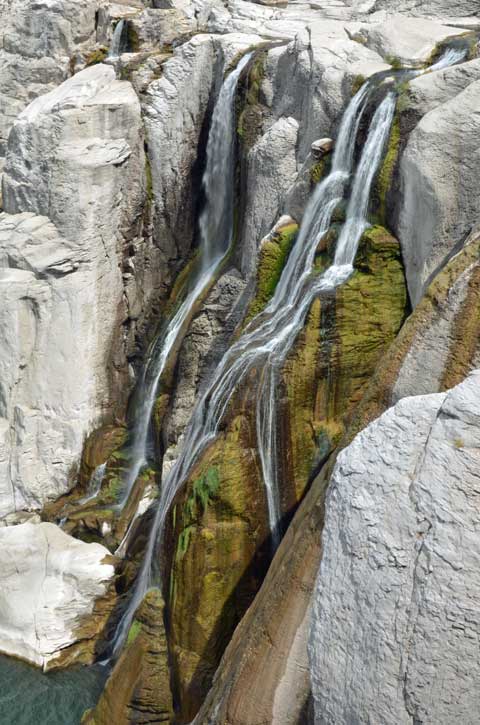
But then we headed down a dirt road (no outlet), in the Snake River valley, to discover amazing waterfalls just sprouting out of the cliffs. Outstanding.

World Potato Museum
Read the sign leading to the town of Blackfoot, ID.
Intrigued that anything in this little place might be world class, we headed straight there.
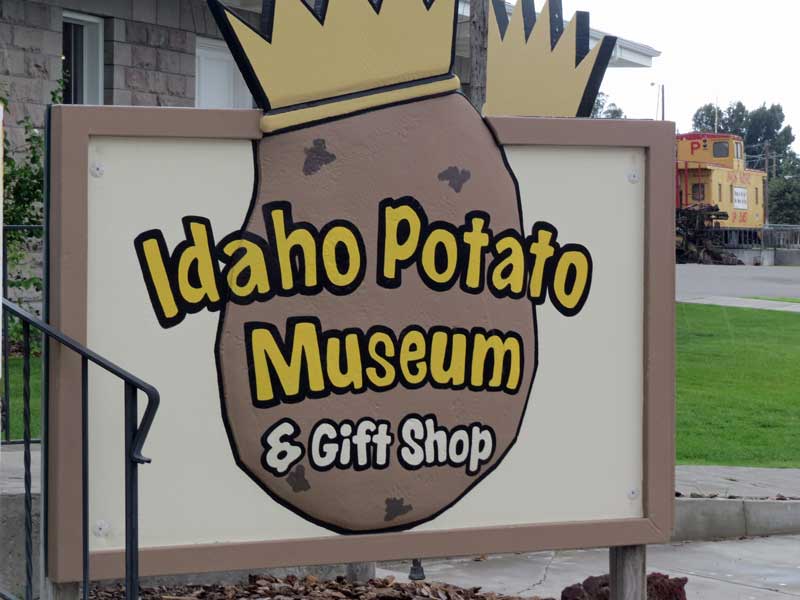 So it turns out that the lady at the museum said that there isn’t any other potato museum in the world, so this place, rightly, claims the title. Well worth the $2.50 admission fee, it’s a darn good museum. If you are out of state, you get a free ‘Hungry Jack’ packet of nearly instant mashed potato, which we had with Atlantic Steelhead trout and peas this very night. Not bad at all.
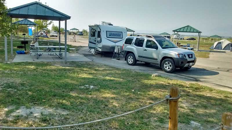
We’re camped at Rock Creek County park in Twin Falls, ID. Water and Leccie for $15 a night. It’s an old landfill that’s been converted into a ‘model’ RV park. Pretty nice it is, too.
Tomorrow:- Shoshone Falls, Balanced Rock, Hagerman Fossil Fields and whatever else we find.
Plus, we might take a brush to the trailer, it’s filthy on the outside (until now, no-one has let us wash it). The Tow Vehicle isn’t too shiny either.
Coming down from a high
28th August 2015
Today, we drove out of Yellowstone National Park, losing elevation slowly, and ending up in the township of Arco, Idaho (not the fuel company, it doesn’t even have an Arco gas station!). Arco is distinguished by being the first community in the ‘non-communist’ (their quote) world to have electricity provided entirely by nuclear fission – the nearby nuclear research facility was the source. We’re at Mountain View RV resort, which is an extremely clean and tidy facility, for very little money (especially with Good Sam discount).
On the way, we stopped at Blisters BBQ, in Rexburg, ID. Located inside of a gas station store, this place was outstanding. Pulled pork slider, waffle fries, bbq beans and a quarter chicken and a drink for $10. Very tasty.
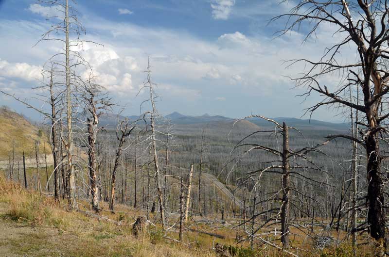
After getting set up at Mountain View RV, we headed for the Craters of the Moon National Monument & Preserve. It has a small campground which looks like a lot of fun – but hand-pumped water, so no filling of tanks.
You’d think that nothing would impress after having 3 days of Yellowstone, but, not true, the narrative and the views were impressive:
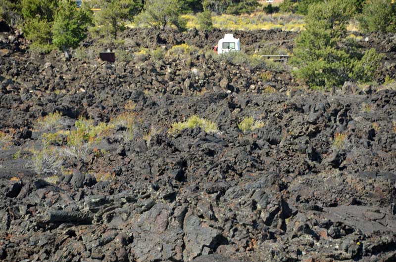 Campground set in lava
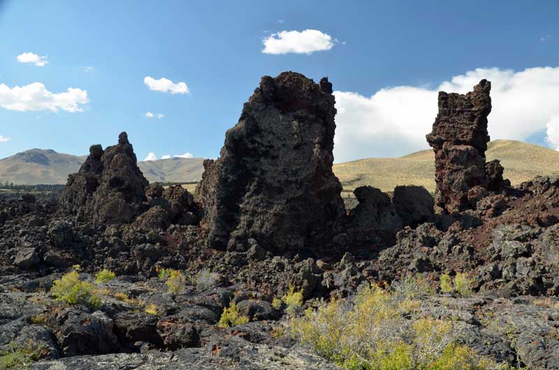 Spatter cones
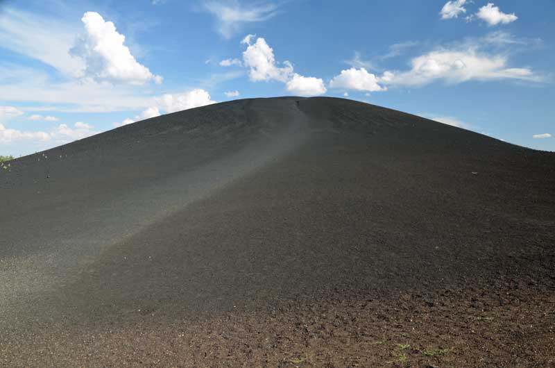 Climbing that thing is farther and steeper than it looks
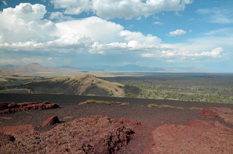 A view from the top
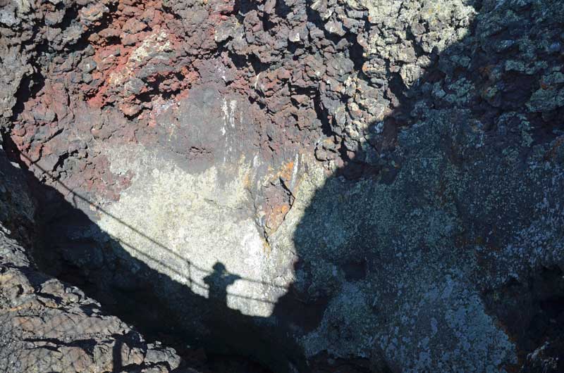 Somebody taking a photo inside a spatter cone
Yellowstone National Park
26th August 2015
Today was plagued by selfie-taking hordes on tour buses! Plus, later in the day, we discovered that a huge length of the road south of Mammoth hot springs had been completely ripped up for miles, causing huge traffic delays. Finally, Laundry.
Despite the above, Yellowstone continues to amaze us.
 Sulfur cauldron
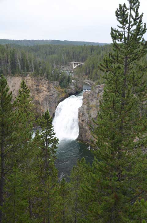 Upper Falls of the Yellowstone Grand Canyon
 Looking down into the abyss
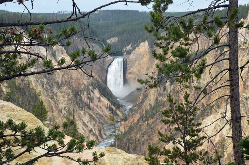 Lower falls
 Lower Falls again
 Inspiration Point
 Mammoth hot springs
Yellowstone National Park
25th August 2015
Busy day – worn out at end of it. We have a bunch of video material, which clearly works well with the dynamic action of the steam and bubbling and water falls. WordPress doesn’t seem to like the ‘.mov’ file type, so mebbe we’ll have to put them on YouTube and leave a pointer here. Hope the stills work.
 Fishing Bridge, with B looking on. Ironic that actually fishing from the bridge is no longer allowed.
 West Thumb
 More West Thumb
 Old Faithful
 Perspective – Old Faithful and crowd
 Biscuit Basin
 More Biscuit Basin
 Firehole Lake Drive

Firehole Canyon Drive
 Gibbon Falls
 More Gibbon Falls

Porcelain Basin
On the way to Yellowstone National Park
24th August 2015
So, a couple of days ago, when we were in Utah State Park, I (Simon) was looking at the map, and trying to think about where to go next. I’d shruggingly figured Idaho, for no particular reason other than we’d never been there, and then, I saw on the map, that Grand Teton National Park and Yellowstone National Park were right there, next to Idaho, in Wyoming.
So I sez to B, ‘How many times in a lifetime are we going to be this close to these parks, with no particular timetable to get home, or anywhere, really? How could we miss the opportunity to go?
So we did, and we are.
Yesterday, we drove North East and ended up in an eye-wateringly expensive KOA Kamp Ground south of Jackson, Wyoming, Which was in a nice spot by the Snake river, but otherwise just workmanlike. They claimed to have wifi, but it was so poorly engineered that it would only work if you stood outside the office on one leg and rotated through 360 degrees every minute whilst holding your device up to the heavens. And even then, it timed out after 5 minutes.
We had no idea what the deal was for camping in Yellowstone was, so we threw ourselves at the mercy of our good friends on the web at Lance Owners of America. In short time we had the web address of the place to make bookings and the place to make a booking for. Thank you guys and gals 🙂 Shortly after that, we had a booking. Yay!
So, off we set this morning. north on 89, turning left on highway 22, with a view to taking Moose-Wilson Road North up through Granite Canyon. Despite there being no warnings, we were turned back as no trailers are allowed. Oh well. Back again to Jackson (congested little city), and then away and on to Grand Teton National Park (drove on right through, will come back later) and to Yellowstone.
We got kind of set up at Fishing Bridge CG (including increasing our stay to four nights), and then headed east to the Eastern Entrance and back, which is where the following photos are from.
At last the air is somewhat clearer.
Pictures follow:
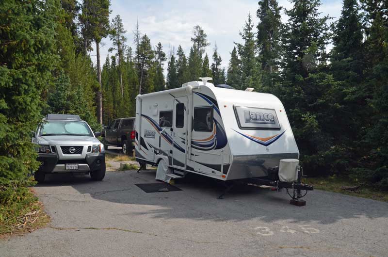 Camp site at Fishing Bridge. Although the spaces are quite cramped, it was perfectly adequate, as we spent very little time there.
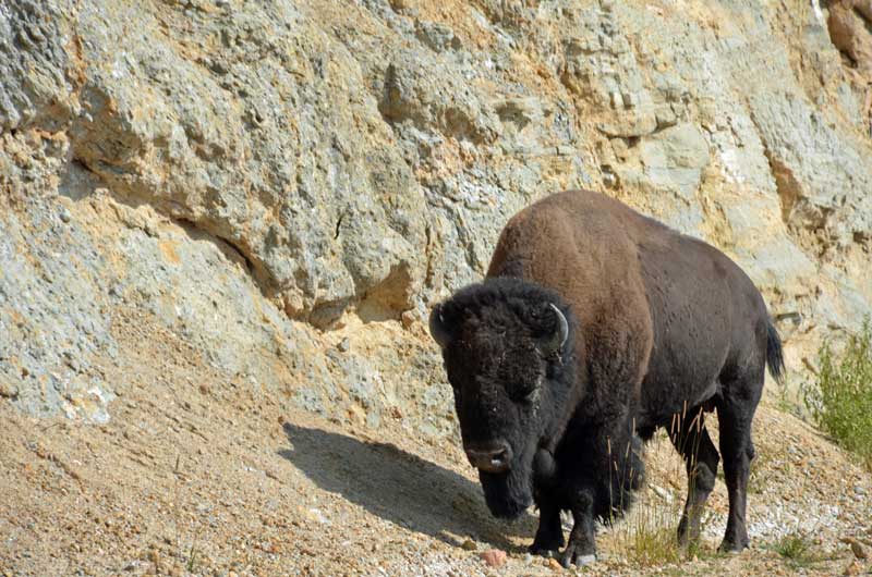 Our first wildlife photo opp., of which there would be many.
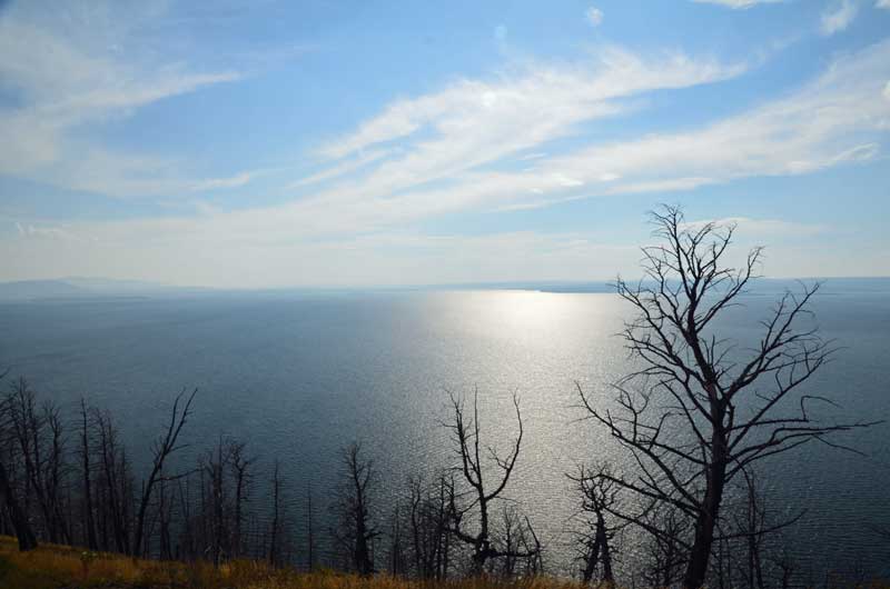 Lake Yellowstone
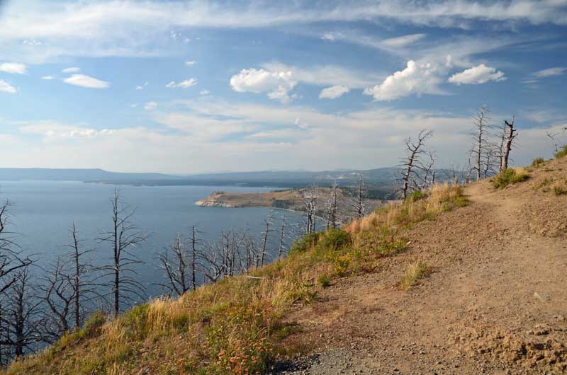 More Lake Yellowstone
Peaceful
Utah Lake State Campground
20th-22nd August 2015
If you like power boats, sailing or fishing, this is the place for you. We liked it, and we don’t currently do any of those activities.
The campground is clean, the sites well separated, each with a huge canopy, power and water, lots of of green space.
Anyhoo, we’ve sojourned here for three days, and it’s been just great to do nothing very much at all. There’s still a lot of smoke about, but the wind is blowing, so it might be better tomorrow. Isn’t that always the way?
Next up, a big surprise, for us, anyway.
Pictures follow:
Our site: A 20. Lots of shade trees in the afternoon

Pretty scene of the river that feeds the lake.
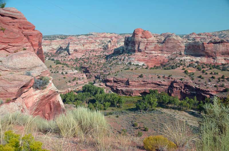
Grand Escalante Staircase & Capitol Reef National Monument
19th August 2015
Grand Escalante Staircase? Isn’t an Escalante a staircase? We weren’t aware, but this description refers to the whole huge area that encompasses all of the National Parks we’ve been in, but also pretty much all the others, too. So driving along Hwy 12 through the town of Escalante does not constitute ‘climbing the staircase’.
That said, it was all pretty lovely, especially ‘Hells Backbone’ which I’d love to ride on a motorcycle some day.
The big downside was that the smoke smog had got thicker, and it was literally impossible to see features more than 500 feet distant. As we travelled 12, it should have been possible to see huge valleys and hills, but not for us, not that day.
Having been advised to eat at the ‘Hell’s Backbone Grill’ in Boulder, we did. It was not a promising start: There was big hammering and construction of shelves in the dining room, the a/c was turned down to arctic, and the food took ages to arrive. The hammering stopped, the temps didn’t change and the food arrived, and it was good. A simple breakfast with a couple of eggs, a couple of potato cakes and an elk sausage with toast shared between us, but beautifully prepared, seasoned, herbed and presented. But, $4.00 each for glasses of not even freshly squeezed orange juice! Oh well.
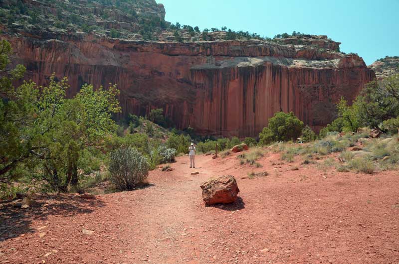
Continuing on, we came to the end of Hwy 12, turned right and were shortly at the entrance to Capitol Reef National Monument. Yup, more red rocks. We were pretty close to being ‘rocked out’, but hey, it’s all good.
It turns out that this canyon was, for a very long time, used by folks to get to Arizona – which is quite amazing considering that it is subject to flash floods and very sticky mud.
Wondering whether it would be too late to comfortably get back to the trailer, we ‘punched in’ its address in Cedar City, and although we’d traveled well over 400 miles in the last couple of days, it was only 150 or so to get back. 150 or so of the most unutterably boring driving along Hwy’s 24 and 62. Why is hwy 62 even there? There’s nowhere it goes or comes from.
After a Starbucks call, a bit of shopping, fill up with gas, back to the campground and our little trailer that we are calling ‘home’ for the next few weeks. Utterly exhausted, we microwaved a freezer ‘seafood medley’ (which was delicious), had a glass of wine, and relaxed.
Pictures follow:
 Scene from Hwy 12

You might not think so, but this is an astonishing shot (by B, with her amazing Canon super zoom point and shooty thing) of an Anasazi granary, way high up on the cliff side along Hwy 12. I looked, and I couldn’t see it. The Belgian family who showed up looked and they couldn’t see it. B knows about these things and spotted it, turned the zoom to +11 and got it. Bravo!
 Capitol Reef
 Capitol Reef
 Capitol Reef
 B taking a photo of me whilst…. Capitol Reef
Bryce Canyon & Kodachrome Basin State Park
Tuesday 18th August
Bryce Canyon
Even though it was only 50 miles as the crow flies from the campground, by the time we’d followed the GPS ‘quickest’ route north on I-15, south east on 20 and then south on 89, it was well over a 100 miles to get to Bryce Canyon. Even so, we were earlier than most, and the crowds weren’t too bad at all until much later in the day.
What can be said about Bryce Canyon that hasn’t been more elegantly by others. It’s mile upon mile of reddish eroded sandstone, where the wind and rain, over geological time, has carved fantastical structures. A bit like the Grand Canyon when first encountered, it’s all too difficult to see in in three dimensions, and looks ‘flat’ like a painting. But it’s not, the amazing vista, on a clear day*, can reach up to a 100 miles or so (* today, it didn’t as smoke from the California and Idaho fires really limited the view).
Between us, B and I took well over 200 photos. The few that follow are just a selection that caught our eye. I really wish that I’d brought the 10-20 mm wide angle lens, as the vista was so wide that it couldn’t be caught (not even close) with the 15 mm widest angle of the main lens.
Pictures follow:
 This photo gives a really limited view of the scale of the place

 Kodachrome Basin State Park
We saw this place marked on the map and were curious. So, after we found accommodations at the excellent Bybee’s Stepping Stone Motel in Tropic, UT, we headed out to take a look. After all the earlier eye-candy, this place seems modest, but if viewed before Bryce Canyon, it would seem outstanding – a lot of eroded vertical stone structures, and, a campground in a fantastic and quiet setting. If we ever get back to this part of the world, this is a place we’d like to stay.


You must be logged in to post a comment.